About the Neil Armstrong Airport
The Auglaize County Neil Armstrong Airport is an authority operated general aviation facility with a rich aviation history. Named for Neil Armstrong, our native son and first person to walk on the moon, the airport handles recreational, corporate, and private travelers. The Neil Armstrong Airport was founded in 1968, beginning with a grass runway and has been expanding ever since.
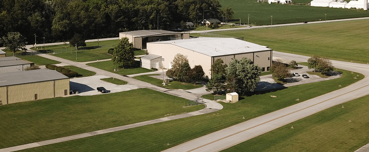
Through continued growth and investment, the airport now has a 5,500-foot long by 100-foot wide grooved asphalt runway capable of handling aircraft weighing in excess of 50,000 pounds. This runway, coupled with its advanced instrument approaches, provides access to Auglaize County in all weather conditions. It is capable of accommodating any size corporate and general aviation aircraft manufactured to-date. Numerous individuals, corporate, and industrial companies, store and maintain their aircraft in the airports roughly 92,000 square feet of hangar space. The airport also has future development opportunities available for those interested in building their own aircraft hangar.
To meet the ever-growing demand and requirements for air travel, the airport has developed plans for a new terminal facility. This facility will provide travelers with an updated portal into Auglaize County. The new terminal will address the future needs of private and business flyers alike.
The Neil Armstrong Airport provides convenient access for domestic and international general aviation flights from Auglaize County. The airport averages 20 flights daily.
Recommended Facility Charges
View ChargesFacility Information for KAXV:
Fuel Farm
24/7 Self-serve AvGas and Jet A/ Jet A+. Two 12,000 gallon above ground fuel tanks. Single point and over-wing fueling capability, with 100ft of hose each product. Most major credit cards accepted. After hours callout available.
Airport Personnel
Normally staffed Monday through Friday, 7am to 5pm excluding Holidays.
After Hours callout available, 24/7.
Please contact Airport Manager at:
419-753-2810
Please be advised, the Neil Armstrong Airport currently does not have Type I/IV de-ice chemicals and may not have hangar space for overnight storage. Please contact the Airport Manager for further details.
| External Link Sites | |
|---|---|
| On Airport METAR | http://www.anyawos.com/KAXV |
| NWS Aviation Weather | www.aviationweather.gov |
| FAA NOTAMs | https://www.notams.faa.gov/dinsQueryWeb/ |
| TFR's | https://tfr.faa.gov/tfr2/list.html |
Attractions:
Neil Armstrong Air & Space Museum
Located in Wapakoneta, within 15 minutes of the airport.
Eldora Speedway
Ohio's premier dirt track, within 30 minutes of the airport
Grand Lake St. Marys
Ohio's largest man made lake, within 15 minutes of the airport.
Americas Largest Bike Museum
Located in New Bremen, within 10 minutes of the airport.
Airstream Trailers
Located in Jackson Center, 20 minutes of the airport
Aircraft Tow Equipment/Tug
2014 Kubota X1100C - capable of towing aircraft in excess of 30,000 lbs
Tron-bar tow bar with Learjet, Citation, and Hawker heads
2013 F350 Pickup
Summer Ops
UNICOM monitored during mowing operations.
2020 Snapper 72" 800 series Zero turn mower
John Deere 6110M utilized with a 16ft Land Pride batwing mower
Winter Ops
UNICOM monitored during winter operations.
2004 International 7400 Single Axle Dump Truck with 14' snow plow blade
2004 International 7400 Single Axle Dump Truck with 16' snow plow blade with 10ft wing blade.
John Deere 6110M utilized with a 16ft box blade, or a 14ft M/B rotary broom
2013 F350 Pickup
Fair Snowcrete 742A two stage industrial snow blower
2014 Kubota X1100C - 7' snow blade
Boss VBX 3000 Spreader – For solid runway deicer application
100 gallon spray tank with a 16ft boom – For liquid runway deicer application
Bowmonk AFM2 Friction Testing device
Airfield NOTAMs updated regularly – Please contact the Airport Manager if you have questions.
Please be advised, the Neil Armstrong Airport currently does not have Type I/IV de-ice chemicals and does not have hangar space for overnight storage.
Airport Information
| Location | |
|---|---|
| FAA Identifier | AXV |
| Lat/Long | 40-29-36.8000N / 084-17-53.1000W 40-29.613333N / 084-17.885000W 40.4935556 / -84.2980833 (estimated) |
| Elevation | 912.5 ft. / 278.1 m (surveyed) |
| Variation | 04W (1985) |
| From city | 8 miles SW of WAPAKONETA, OH |
| Time zone | UTC -5 (UTC -4 during Daylight Saving Time) |
| Zip code | 45871 |
| Airport Operations | |
|---|---|
| Airport use | Open to the public |
| Activation date | 05/1956 |
| Sectional chart | DETROIT |
| Control tower | no |
| ARTCC | INDIANAPOLIS CENTER |
| FSS | DAYTON FLIGHT SERVICE STATION |
| NOTAMs facility | DAY (NOTAM-D service available) |
| Attendance | MON - FRI 0700-1700 |
| Pattern altitude | 1912.5 ft. MSL |
| Wind indicator | lighted |
| Segmented circle | no |
| Lights | ACTVT MIRL RY 08/26; REIL RY 08 & 26 - 122.7. |
| Beacon | white-green (lighted land airport) Operates sunset to sunrise. |
| Airport Communications | |
|---|---|
| CTAF/UNICOM | 122.8 |
| WX AWOS-3 | 128.325 (419-753-2821) |
| COLUMBUS APPROACH | 134.0 |
| COLUMBUS DEPARTURE | 134.0 |
| CLASS C | 134.0 |
| WX AWOS-3 at SCA (17 nm SE) | 120.425 (937-492-3683) |
| WX ASOS at AOH (18 nm NE) | 128.725 (419-224-6098) |
| Nearby radio navigation aids | |||
|---|---|---|---|
| VOR radial/distance | VOR name | Freq | Var |
| RODr322/17.0 | ROSEWOOD VORTAC | 117.50 | 05W |
| DQNr010/29.0 | DAYTON VOR/DME | 114.50 | 01W |
| FBCr224/37.1 | FLAG CITY VORTAC | 108.20 | 02W |
| Airport Services | |
|---|---|
| Fuel available | 100LL JET-A1+ |
| Parking | tiedowns |
| Airframe service | MAJOR |
| Powerplant service | MAJOR |
| Bottled oxygen | HIGH |
| Bulk oxygen | HIGH |
Runway Information
| Runway 8/26 | ||
|---|---|---|
| Dimensions | 5500 x 100 ft. / 1676 x 30 m | |
| Surface | asphalt/grooved, in good condition | |
| Runway edge lights | medium intensity | |
| RUNWAY 8 | RUNWAY 26 | |
| Latitude | 40-29.507792N | 40-29.717897N |
| Longitude | 084-18.461610W | 084-17.307475W |
| Elevation | 907.8 ft. | 908.3 ft. |
| Traffic pattern | left | left |
| Runway heading | 081 magnetic, 077 true | 261 magnetic, 257 true |
| Displaced threshold | 700 ft. | 237 ft. |
| Markings | nonprecision, in good condition | nonprecision, in good condition |
| Visual slope indicator | 4-light PAPI on left (4.00 degrees glide path) | 4-light PAPI on left (3.00 degrees glide path) |
| Runway end identifier lights | yes | yes |
| Touchdown point | yes, no lights | yes, no lights |
| Instrument approach | LOC/DME | |
| Obstructions | 91 ft. trees, 455 ft. from runway, 270 ft. left of centerline, 2:1 slope to clear RWY 08 APCH SLOPE 12:1 TO DSPLCD THLD DUE TO +91 FT TREE 1155 FT DISTANCE 270 FT L. | 15 ft. road, 330 ft. from runway, 275 ft. right of centerline, 8:1 slope to clear RY 26 APCH SLOPE 15:1 TO DSPLCD THLD DUE TO +16 FT ROAD 452 FT DSTC 275 FT R. |
| Airport Ownership and Management from official FAA records | |
|---|---|
| Ownership | Publicly-owned |
| Owner | AUGLAIZE CO ARPT AUTH BOX 400 NEW KNOXVILLE, OH 45871 Phone 419-753-2810 |
| Manager | TED BERGSTROM BOX 400 NEW KNOXVILLE, OH 45871 Phone 419-753-2810 SAT-SUN ARPT SVC ON CALL AS NEEDED 419-753-2810. |
| Airport Operational Statistics | |||
|---|---|---|---|
| Aircraft based on the field | 30 | Aircraft operations: avg 27/day* | |
| Single engine airplanes | 26 | 51% | local general aviation |
| Jet airplanes | 4 | 31% | transient general aviation |
| 18% | air taxi | ||
| <1% | military | ||
| * for 12-month period ending 08 May 2018 | |||
Instrument Procedures
NOTE: All procedures below are presented as PDF files. If you need a reader for these files, you should download the free Adobe Reader.
NOT FOR NAVIGATION. Please procure official charts for flight.
FAA instrument procedures published for use between 6 February 2014 at 0901Z and 6 March 2014 at 0900Z.
This information has been provided by: AirNav.
IAPs - Instrument Approach Procedures
| Attachment | Size |
|---|---|
| RNAV (GPS) RWY 08 | 193.16 KB |
| RNAV (GPS) RWY 26 | 214.9 KB KB |
| VOR-A | 166.7 KB |
| NOTE: Special Take-Off Minimums/Departure Procedures apply | 292.34 KB |